 +30 697.38.37.123
Info@SeaYou.gr
+30 697.38.37.123
Info@SeaYou.gr
SeaYou | Seamanship, Navigation & Education
It is a reasonable answer.
Why spend time learning to read a nautical chart when a smartphone can display your position, calculate distances and help you plan a route? Why learn to plot coordinates manually when an application can do it in seconds?
Modern navigation technology is genuinely useful. Electronic charts and navigation applications have made information more accessible and route planning more convenient. Used correctly, they are valuable tools for recreational sailors and professional skippers alike.
But there is a question worth asking:
Are we learning to navigate, or are we learning to operate a navigation application?
The distinction matters.
Because the purpose of learning to read a nautical chart is not simply to have an alternative when electronics fail. It is to develop a deeper understanding of the environment in which we navigate.
And that understanding begins long before anything goes wrong.
At first glance, a nautical chart may appear complicated. It contains soundings, depth contours, symbols, abbreviations, coordinates, navigational marks and information about hazards.
To an inexperienced user, these may look like details to memorise.
To a trained navigator, they form a connected picture of the underwater terrain, the coastline, the available water, the hazards and the relationships between different locations.
Reading a chart requires us to interpret information rather than merely observe it.
What does the depth information tell us about the seabed? How does the shape of the coastline influence our approach? Where does safe water become restricted? What does the chart reveal about a potential anchorage, and what additional information would we need before deciding to use it?
These are not just questions about symbols.
They are questions about the physical environment and the consequences of our decisions within it.
A nautical chart becomes meaningful when we learn to translate its information into an understanding of the sea around us.
One of the most valuable aspects of chartwork is the way it encourages us to think spatially.
When plotting a position, measuring a distance or laying off a bearing, we are working with relationships between locations, directions and distances.
We begin to understand where we are in relation to where we want to go, how the coastline is oriented, how much room is available to manoeuvre and how our intended track relates to nearby hazards.
This process encourages us to build a mental representation of the environment.
Instead of seeing our vessel as a symbol moving across a screen, we begin to understand its position within a larger geographical context.
Research into spatial cognition and navigation suggests that these abilities can be developed through purposeful training, although the results depend on the task, the learner and how maps are used. The important point is not that paper is inherently superior to digital technology. It is that spatial understanding benefits from active engagement with the information we use to navigate.
For a skipper, this has practical value.
The better we understand the relationships between our position, our intended course, the coastline and the surrounding hazards, the better equipped we are to interpret changing circumstances.
We are not simply following a line.
We are learning to understand the space through which that line passes.
Consider a simple exercise.
You are planning a passage between two Greek islands. Your navigation application offers a route, displays the distance and indicates the direction of travel.
You could accept the route and move on.
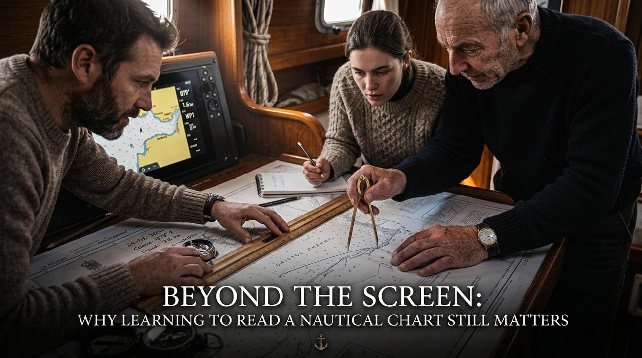
Alternatively, you could take a nautical chart and work through the passage yourself.
Plot the departure and arrival positions. Measure the distance. Determine the intended course. Identify the hazards along the way. Examine the depths and the shape of the coastline near your destination. Consider where you might need additional clearance or an alternative plan.
Then ask yourself:
What could make this route unsuitable under different conditions?
Which sections require particular attention?
Where would I want to reassess my position?
What alternatives are available if the intended approach becomes unsafe?
The application may provide some of these answers, depending on its features and the information available. But the educational value lies in the process of examining the route and understanding why it is suitable—or why it may not be.
You are practising the relationship between information, interpretation and decision-making.
You are also learning to question an answer rather than simply accept it because a device has produced it.
That is an important distinction in seamanship.
A moving vessel is part of a changing environment.
Its position alone does not tell the whole story.
A skipper must interpret that position in relation to the vessel’s heading, movement over the ground, nearby hazards, prevailing conditions and the intended passage.
Electronic navigation can make this information easier to access. Depending on the equipment and its configuration, it can also integrate information from several instruments.
But displayed information still needs to be interpreted.
Is the position reliable? Does the indicated track make sense in relation to the surroundings? Are the chart data, scale and displayed details appropriate for the decision being made? Does the planned route leave adequate room for the conditions and uncertainties involved?
A competent navigator does not need to distrust every electronic display. Equally, competence does not mean accepting every display without question.
It means understanding what the information represents, what its limitations are and how it fits into the wider situation.
This is where chartwork becomes more than a traditional classroom exercise. It helps establish the knowledge needed to make sense of navigational information, whether it appears on paper or on a screen.
It would be easy to turn this discussion into an argument between paper charts and electronic navigation.
That would miss the point.
Digital tools can support learning, and electronic charts can be excellent training resources when students actively work with them. Equally, a paper chart does not automatically make someone a better navigator simply because it is made of paper.
A student can mechanically copy a plotted route without understanding it. Another can use a digital chart to investigate hazards, compare alternative passages and develop a strong understanding of the surrounding geography.
The difference is not necessarily the medium.
It is the quality of the learning process.
Are we asking students to think, interpret, calculate, compare and explain their decisions? Or are we teaching them to follow instructions without understanding the reasoning behind them?
For sailing education, this distinction is fundamental.
The objective should not be to produce someone who can operate a particular application. It should be to develop a navigator who understands the principles behind the information being displayed.
That knowledge remains relevant even as equipment, software and interfaces change.
There is, of course, another reason to learn traditional chartwork: resilience.
A phone can lose power. A chartplotter can fail. A positioning source can become unavailable. A system may provide misleading information, or the conditions may make it difficult to interpret the display confidently.
Having an alternative way to reason about position and movement is an important part of sound seamanship.
But we should be careful not to confuse a paper chart with a complete emergency solution.
A chart does not establish the vessel’s current position by itself. The navigator still needs suitable observations, reliable reference information and the ability to estimate uncertainty. Dead reckoning can help maintain an estimated position, but its accuracy deteriorates over time as errors in course, speed, wind and current accumulate.
Nor does carrying a second device guarantee genuine redundancy if both devices depend on the same vulnerable source of power or positioning data.
The answer is not to abandon technology.
It is to develop enough understanding to recognise limitations, use independent information where available and respond appropriately when confidence in the navigation picture decreases.
Traditional chartwork is one part of that broader competence.
The quieter months can provide an excellent opportunity to revisit navigation without the pressures of an actual passage.
You do not need to be at sea to practise many of the underlying skills.
Choose a familiar route and work through it on a nautical chart. Plot the positions. Measure distances. Identify hazards and examine the approaches to possible destinations.
Then challenge yourself.
What would change if the wind direction were different? Which alternative would you consider if the planned destination became unsuitable? Where would you want to obtain another reliable position fix? Which assumptions in your plan would need to be checked before departure?
You can repeat the exercise using an electronic chart and compare the results.
The objective is not to prove that one method is better than the other. It is to understand the route well enough to explain your choices and recognise when circumstances require you to reconsider them.
For instructors, this also creates an opportunity to teach beyond procedures.
Ask students why they selected a route. Ask them to identify the uncertainty in their calculations. Ask them to explain what information they would need before making a decision.
A correct answer is useful.
Understanding why it is correct—and when it might no longer be correct—is far more valuable.
A skipper’s development should not stop at the ability to operate the equipment installed on a boat.
Equipment can be replaced. Applications can be updated. Interfaces can change.
The underlying principles of navigation remain essential: position, direction, distance, depth, hazards, observation and the relationship between the vessel and its environment.
Learning to read a nautical chart gives us a structured way to work with these principles. It can strengthen spatial reasoning, encourage disciplined observation and help us build a more coherent understanding of the waters through which we travel.
These benefits do not appear automatically. They develop through practice, feedback and instruction that requires students to think rather than simply follow.
And they are not confined to situations in which electronics fail.
They matter during ordinary passages, when evaluating an unfamiliar approach, when questioning an unexpected display and when deciding whether a planned route still makes sense.
The best time to develop these skills is before we need to depend on them.
There is nothing wrong with having Navionics on your phone.
There is nothing wrong with using a chartplotter to plan a passage, monitor your position or make navigation more efficient.
The question is whether the technology supports your understanding or substitutes for it.
A capable skipper should be able to explain the route, recognise the hazards, question the information and understand the decisions being made—not merely point to a line on a screen.
Do not learn to read a nautical chart only because your electronics might fail. Learn to read it because understanding the sea is part of learning to navigate.
Technology can show you the route.
Your training should help you understand it.